Have your say on the preferred route for the Lake-to-Lake bicycle pathway.
Now that the route has been identified, the city of Penticton wants to hear from residents and businesses who may be affected. You have until Oct. 18 to provide feedback.
The city hosted a webinar on Friday evening (Oct. 9), explaining the preferred route and what it could look like, including how barriers would work, along with the two-way bike lanes.
Around 775 people tuned into the webinar and more than 75 comments were made about the route, many of them worried about how much street parking would be lost, how busy Fairview is, how garbage pick up would work and why didn’t the city use the already existing channel parkway for the route.
READ MORE: City wants feedback on route options
City engagement strategist JoAnne Kleb hosted the webinar along with Richard Drdul, of Drdul Community Transportation Planning who was hired as a consultant for this process.
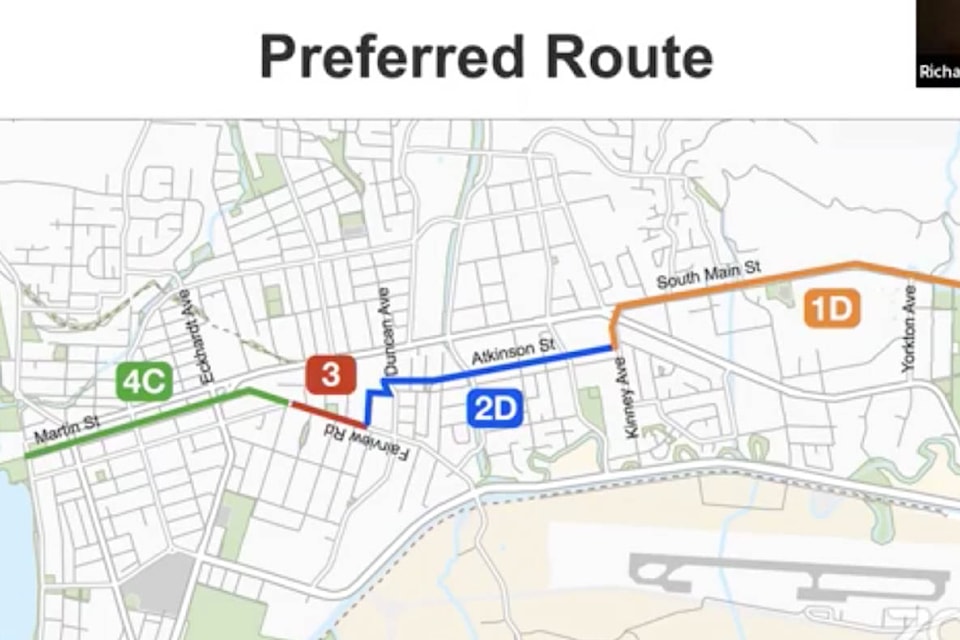
The preferred route, which stretches about 6.5 km, starts at Okanagan Lake at Martin Street. It features a two-way cycle track on the west side of Martin St. Traffic lanes on the one way street are not affected. Parking would be eliminated on the west but maintained on the east.
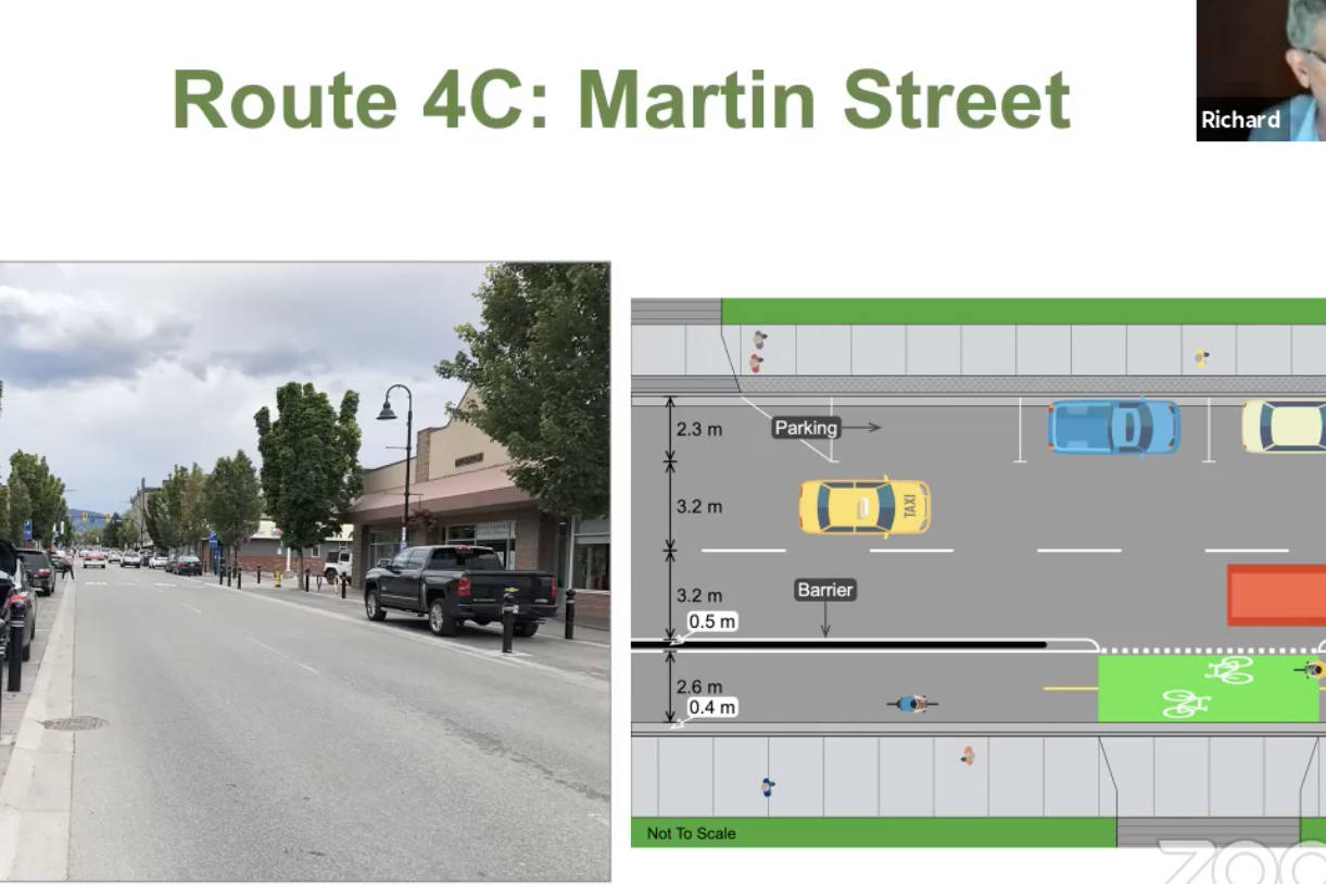
Drdul told the webinar that Time Winery’s patio would be impacted and they would lose all parking in front. All the businesses on the west side would be impacted.
He said they are going to try to work with Time Winery and those businesses during the design phase of the project.
The bike route then carries onto Fairview Road. It features a two-way cycle track on the east side of Fairview Rd. and connects with Atkinson via the multi-use pathway north of Duncan.
Atkinson will feature protected bicycle lanes on both sides of Atkinson St. The barriers would not impede access to driveways, said Drdul.
The intersection at Atkinson/Duncan will be improved with a new traffic signal for pedestrians, cyclists and motorists. This was the chosen route because it provides direct access to Cherry Lane shopping centre, Safeway and other businesses on Main Street, said Kleb.
The route carries on to South Main using protected bicycle lanes. The bike lane on the east side is separated with curbs. The bike lane on the west is reconfigured so the bike lanes are behind and protected by parked cars.
“The need for a safe and convenient cycling route for all ages and abilities through the city and connecting the Okanagan and Skaha lakes was first identified in the 2012 Cycling Plan update and reaffirmed in the draft of the 2019 Official Community Plan,” said Kleb. “It has also been identified as one of council’s priorities.”
In 2019, the City hired CTQ Consultants and Drdul Community Transportation Planning to carry out the project.
Winnipeg Street was a suggested route, but after a survey revealed more people preferred Martin, that route was preferred.
“This is our last round of engagement. In the next phase, we will be looking at funding options, including provincial grants. Depending on funding, it will be a decision on council how to proceed.”
Go to shapeyourcitypenticton.ca or email city hall at get connected@penticton.ca or phone 250-490-2586.