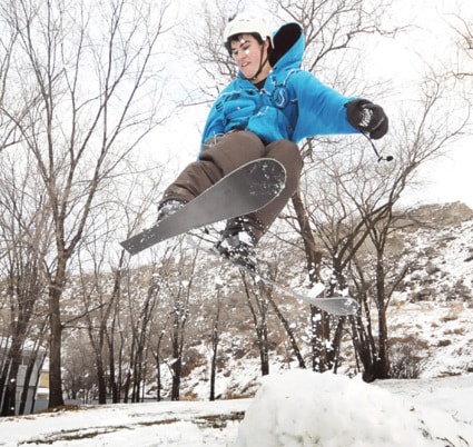
Early this week Penticton area residents were still digging out from Sunday’s near-record snowfall which caused havoc on city streets for motorists and pedestrians.
The heavy, wet snow which topped the 17 centimetre mark was blamed for a number of minor traffic accidents, however, Penticton RCMP reported no major collisions.
During a 24-hour period at Penticton Regional Airport just over 17 cm of snow was reported, the heaviest February snowfall since 21.1 cm fell on Feb. 4, 1973.
“Because we’re a desert, any day we get snow it’s probably a (daily) record, so because in 30 years it just happens to snow two centimetres today that’s a record,” said David Lundquist, B.C. Interior warning preparedness meteorologist with Environment Canada in Kelowna. “But preliminary results indicate this was the second highest (for February) and that’s fairly significant.
“I noticed in talking to people across the Okanagan that it’s a pretty even snowfall, which is also quite unusual.”
And the strange weather was not just confined to the Valley.
“The cold air that lead up to this stretched all the way down to northern Mexico,” he said.
“So when you add in the dew point and the wind speed, Phoenix Ariz. was colder than Whitehorse, and we don’t get to say that much.”
The main culprit for the large snowfall, according to the meteorologist, was the cooler northwest airflow which, depending on the elevation and proximity to large bodies of water, can delay the snow turning to rain.
Lundquist credited the work of the Environment Canada storm warning centre which issued alerts about the pending snowfall over a day ahead of time.
“They (centre) put out the actual warnings on Saturday afternoon at about three o’ clock and it didn’t really start snowing heavily until the morning on Sunday,” he said. “To me, that’s well done to pin it down. The timing was really close, and the amount.
“It’s difficult to predict — the B.C. Interior is the worst because the mountains just mess things up, especially with that northwest flow.”
Lundquist called for a cooling trend for the remainder of this week with a chance of rain or flurries on Friday.
“The flow is different though,” he said. “It’s not a northwest flow, so I don’t see in the next week a dump as big as this last one. That would be unprecedented, so this will be the more typical winter-type weather.”
