“It’s not quite as high as ’72,” Anna Bartlett, from Don and Anna’s Greenhouses said referring to the Similkameen River.
Bartlett took the Review on a drive through her property just off Highway 3, west of Keremeos, a few-hundred feet from the iconic Red Bridge Tuesday morning.
“Back in ’72 they had a crane in the river and the crane was there to pick out logs. The river was just level to the bridge and they had to keep picking the trees and debris out so it didn’t create a jam and make things worse,” she said. “It’s not quite that high yet. It’s got a few feet of room but not too much.”
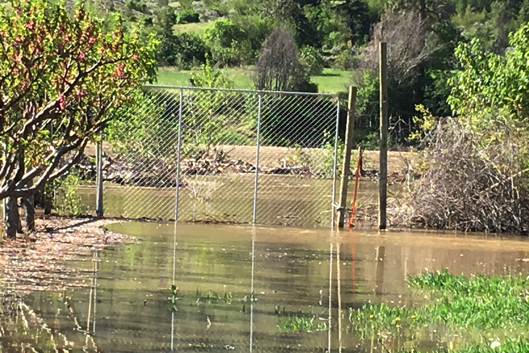
Where the greenhouses sit now, were tomato and potato fields. When the flood hit the spring of ’72 that field was covered in about two-feet of water.
Several roads in the area were flooded as the Similkameen River spread to almost a kilometre wide. Flooding was widespread in Keremeos and Cawston.
The greenhouses were heavily damaged in 2005 during an ice jam. The ice came in the same way the water did in ’72.
“It comes in the low lying areas. We’ve worked to build it up, but we’ll see. I don’t know how much it’s going to keep out,” she said.
Although nothing is coming in yet from the west, the back of the property, which is up against the mighty Similkameen, is starting to flood at their neighbours property.
Although the forecast isn’t good, with warm temperatures and even rain predicted, Bartlett is trying to stay to positive.
“Well, what can you do? I’m hopeful it’ll stay cool,” she said.
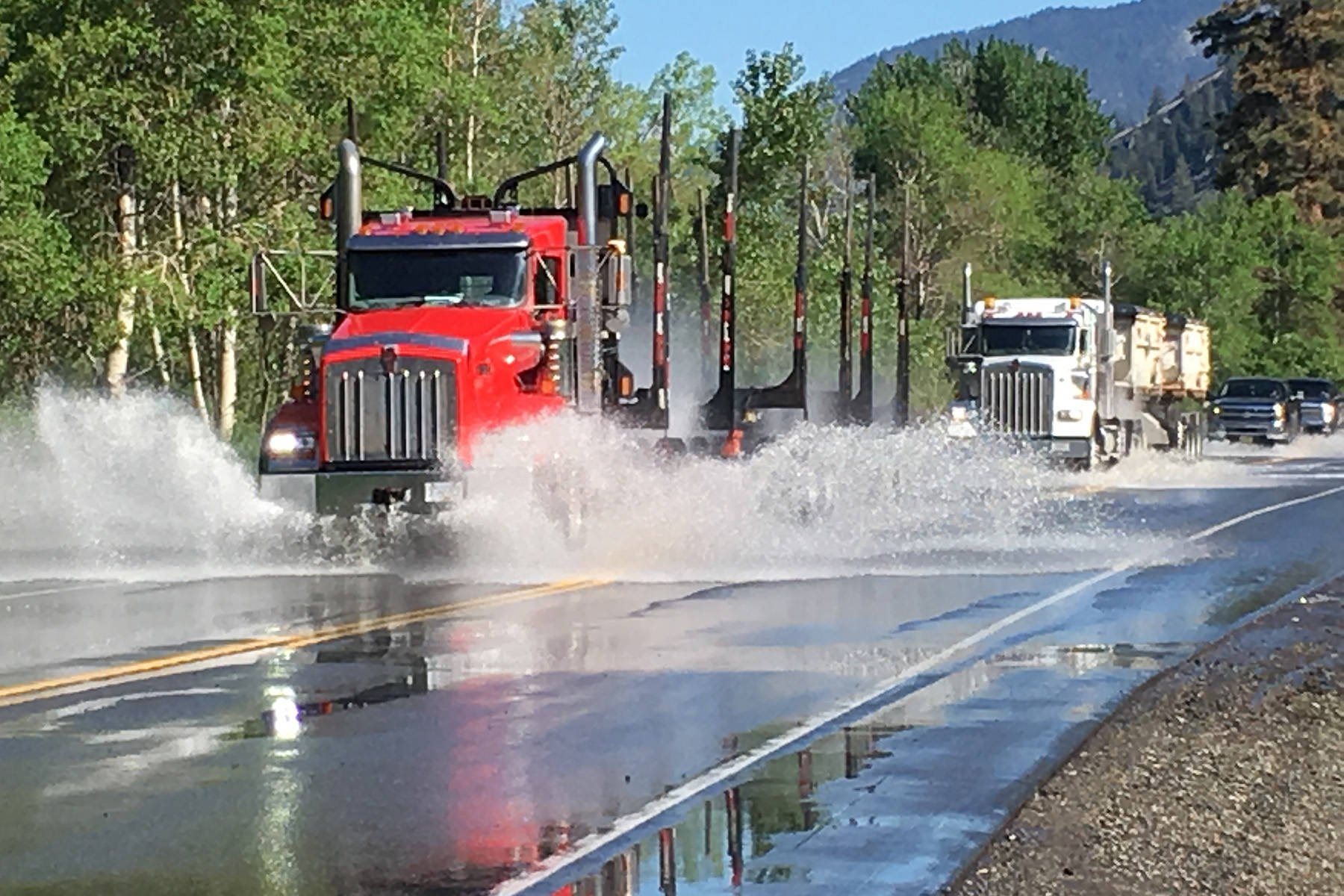
About 15 kilometres west of Don and Anna’s Greenhouses the river was overflowing its banks along Highway 3, near the Lawrence Ranch.
Crews from Argo and the Ministry of Forests, Lands and Natural Resource Operations were on scene Tuesday morning.
About a foot of water was on the roadway in its deepest spot, with cars creating big sprays of water as they drove through. Water was pooled on either side of the highway. A front-end loader was working to clear debris in a ditch by the road by mid-morning.
By Tuesday afternoon the Regional District Okanagan-Simikameen declared a state of local emergency for Area G (Rural Keremeos, Hedley) because of the rising river.
Keremeos Mayor Manfred Bauer said the village is in close contact with the Emergency Operation Centre in Penticton overseen by the Regional District Okanagan-Similkmaeen.
“As you know the River Forecast Centre has upgraded from a high flow stream advisory to flood watch and that’s really all I can tell you at the moment,” he said. “We’ll have to keep a close eye on it. We’re working closely with the Emergency Operation Centre where all the organizations are in one room. If we have to take more steps towards a greater alert we’ll do that with our residential alert notification system.”
As of press time only Area B and Area G were under State of Local Emergency designation - meaning the RDOS can take charge of mediation efforts and the province can st
ep up with emergency funding. Members of the BC Wildfire Service were in Olalla last week helping to sandbag around homes on the floodplain, which experience flooding every year.
The dike in Cawston received emergency repairs last week as well after the State of Local Emergency was called.
Bauer said the dike in Keremeos, which has been maintained by the village since 1972 is in good shape. Regular assessments and work are done on the dike each year.
Most recently some tree removal occurred, so that when high water comes the trees aren’t ripped out, destabilizing the dike, Bauer said.
Because of high water flows, the Washington Department of Ecology issued flood warnings along the Similkameen and Okanagan rivers in the U.S.
The most recent data collected near Knighthawk Tuesday afternoon showed the river level at 13.6 feet, which would cause a minor flood. But the river is expected to peak for the week on Friday at about 15.29 feet, just shy at what is considered a major flood at 16-feet.
Water woes are also happening in other areas of the Lower Similkameen. Pools of water have accumulated on multiple farm properties in the Lowe Drive and Ritchie Drive area.
The creek that flows along Upper Bench Road, near the Grist Mill and Gardens, has breached its banks multiple times this spring.
Chris Mathieson said he along with neighbours and other volunteers spend hours sandbagging along the creek.
The creek spills over the roadway at least once a day mainly because the culvert becomes filled with debris.
“About 10 days ago this started happening. At first it was just little spills here and there, but the water has not come down, in fact, it’s come up quite a bit so we’re keeping a close eye on things ,” Mathieson, operator of the Grist Mill said. “We’ve lost a bit of gravel here and there but we’re pretty lucky. Our neighbours have had their whole driveway wash out. It could get a lot worse so we’re keeping a close eye on it.”
Check www.keremeosreview.com for more information on flooding and other localews.