Spring runoff could be forceful and last into June, the Regional District of Okanagan-Similkameen said.
“Annual snowmelt is beginning throughout the region. When temperatures rise above 20 degrees and it remains warm for a few days, freshet or spring snowmelt starts,” said Brad Dollevoet, RDOS Emergency Operations Centre director in a release.” Above average snowpacks indicate that spring runoff could be vigorous and may last well into June.”
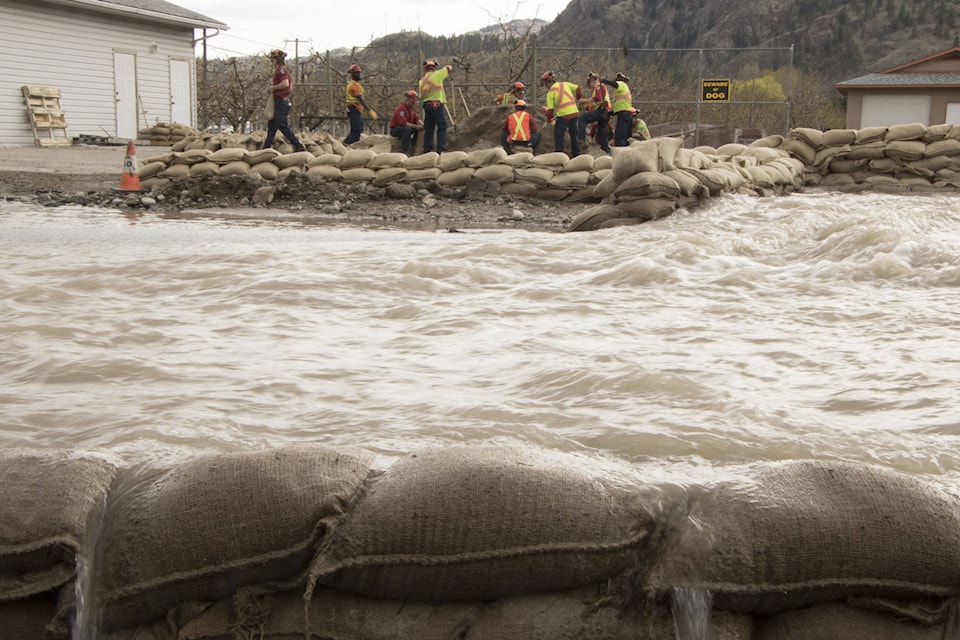
Related: 33 Oliver-area homes evacuated due to flooding
Freshet can become a problem when winter snow packs melt rapidly, overwhelming stream channels and creating floods. Spring freshet can also destabilize soil and rock and cause unpredictable mudslides, landslides and rock slides.
Dollevoet said that many low-lying areas went into the fall and winter with high levels of ground water saturation, which may have contributed to some of the localized slides and debris flows.
“Property owners have a window of dry, sunny weather for the next few days to prepare. This is the opportunity for those living in vulnerable areas, on or near floodplains, or those who have experienced spring flooding in the past to be ready. If you sandbagged properties adjacent to creeks, streams or waterways last year, you may have to again this year,” Dollevoet said.
“Assessing your property and buildings for potential drainage issues is an important proactive measure. Addressing these issues now and safeguarding, can reap big rewards when the snowmelt begins.”
Related: Oliver flooding swells over the course of a week
Dollevoet encourages having an emergency plan in place to insure family members and their needs are considered, taking steps to reduce damage to homes and possessions and plans for pets and livestock will make evacuation easier or increase the ability to withstand unexpected weather events.
Definitions to know
Evacuation Stages
- Evacuation Order: You are at risk. Leave the area immediately. Local police or RCMP enforce evacuation
- orders.
- Evacuation Alert: Be ready to leave on short notice. If you leave before or during this alert, it’s called a
- voluntary evacuation.
- Evacuation Rescind: All is currently safe and you can return home. Stay tuned for other possible
- evacuation alerts or orders.
Flooding Terms
- Flood Warning: River levels have exceeded capacity or will exceed it imminently, and that flooding of
- areas adjacent to affected rivers will result.
- Flood Watch: River levels are rising and will approach or may exceed capacity. Flooding of areas
- adjacent to affected rivers may occur.
- High Streamflow Advisory: River levels are rising or expected to rise rapidly, but no major flooding is
- expected. Minor flooding in low-lying areas is possible.
Current snowpack conditions can be found through thr River Forecast Centre, and information on advisories and flood-related information is available through EmergencyInfoBC, @EmergencyInfoBC on Twitter. For information on preparing for floods, go to PreparedBC.
The RDOS has re-established sand and sand bag locations for residents.
@VernonNews
newstips@vernonmorningstar.com
Like us on Facebook and follow us on Twitter.