Eighteen Penticton Search and Rescue (PENSAR) members responded to two calls for assistance from B.C. Emergency Health Services (EHS) and the RCMP Saturday (Jan. 23) afternoon.
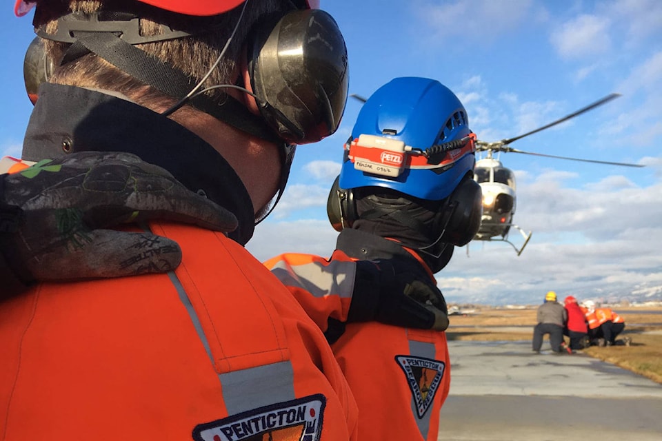
PENSAR first responded with air and ground rescue crews to assist EHS with a medical evacuation in the Nickel Plate Lake area near Apex Ski Resort around 2:45 p.m. Saturday.
9-1-1 had received a report of a middle aged woman in medical distress while she was snowshoeing in the Nickel Plate Nordic trails.
READ MORE: Penticton Search and Rescue airlifts injured hiker off mountain
Due to the urgency of the call, PENSAR responded with an air evacuation and ground teams, while local ski patrol members from the Nordic and alpine area offered on scene care until air evacuation arrived.
The woman was airlifted directly to Penticton Regional Airport where she was transferred to an awaiting ambulance.
As soon as PENSAR’s helicopter landed they were immediately called out to another rescue, said PENSAR manager Randy Brown.
“No sooner had our helicopter team landed at the airport and our rescue trucks turned back to Penticton when we received another call from the Victoria Emergency Coordination Centre,” Brown said.
Penticton RCMP were requesting assistance in locating a lost hiker in the Mahoney Lake area southwest of Okanagan Falls.
PENSAR called out additional resources and rerouted the Nickel Plate teams to the Mahoney Lake area. Search teams were sent out on local trails and located a cold but otherwise healthy female hiker at 6 p.m.
Brown said that both rescues were completed quickly thanks to good cell communications with the injured and lost people.
In the first rescue, PENSAR received GPS coordinates from one of the snowshoers who used an app on his phone to provide the exact location to rescuers.
In the next event, searchers were able to have consistent contact with the lost hiker and used her cell signal to identify her location.
Brown said that both rescues serve as a good reminder to be prepared when heading out into the wilderness.
“Have a trip plan, take the essentials - food, water, extra clothing, signalling device, compass, extra phone batteries.”
Downloading the app Trailforks is also something Brown highly recommends.
For outdoor planning and tips go to AdventureSmart.ca.
READ MORE: B.C. drivers caught crossing, merging over solid white lines face hefty fine
jesse.day@pentictonwesternnews.com
Like us on Facebook and follow us on Twitter