The rain forecast for the Okanagan through till the end of the week could lead to “extreme” flooding, according to the head of the River Forecast Centre.
“The biggest piece of uncertainty is how much rain we get in the next 24-36 hours,” David Campbell told reporters during a Thursday afternoon flood update.
Flows in the Similkameen River are at 600 cubic metres a second now, and could hit as high as 800 cubic metres per second in the next couple days.
Related: Osoyoos Lake shows tepid growth as long weekend approaches
“Obviously a concerning couple of days through the Similkameen over the weekend, but hopefully as we get into next week we should see some easing off,” Campbell said.
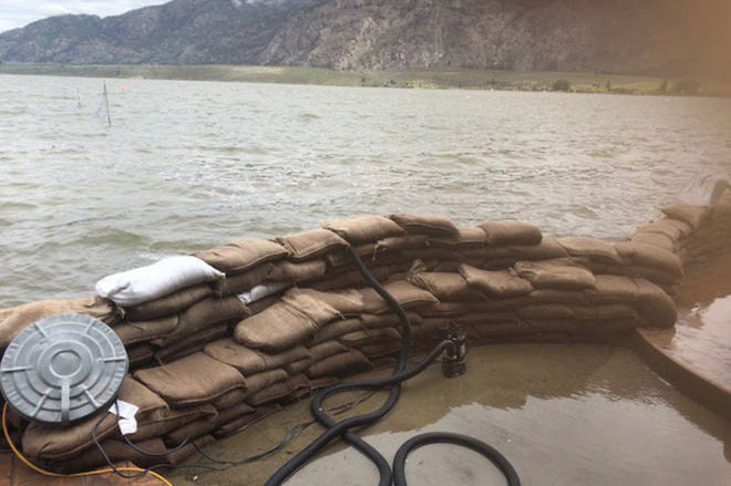
Shaun Reimer, who is the section head for public safety and protection in the Okanagan for the forests ministry, said flooding in Osoyoos Lake will depend on the “backwater effect” of the Similkameen River.
“At times, the peak on the river can be higher than the elevation of the lake itself,” said Reimer.
“That can reduce, dramatically, the outflows of the lake itself. The level of Osoyoos Lake will rise and fall with the rise and fall of the Similkameen River.”
Related: More evac alerts in rural Keremeos
Reimer, who is in charge of releasing water from Okanagan Lake, says levels are rising by five to six centimetres a day.
The last week of rainfall and snowmelt has caused the province to reevaluate max lake levels.
“The plan for flood protection measures on Okanagan Lake is up to an elevation of 343 metres above sea level,” he said.
“That’s approximately half a metre higher than our full pool.”
Related: Osoyoos hotel hopes to reopen early June after flooded by lake
Reimer cautioned the area’s residents not to panic, noting this was the level that flood protection works should be built up to and not a guarantee that the lake would rise that high.
However, he said water was coming into Okanagan Lake even faster than it did in 2017 because of the “historic” heatwave.
“We’ve very vulnerable to the rain right now. If we get a substantial amount of rain… that would be setback for us.”
Last week, Reimer said authorities were forced to reduce outflows from Okanagan Lake because levels in the Okanagan River were damaging flood protection structures.
Related: Osoyoos Lake expected to clear historic 917-foot mark
“If those structures were to fail … they could dam up our system and threaten the communities down to the south.”
But as tributaries are expected to drop over the next couple of weeks, Reimer said the province would once again increase outflows.
Okanagan Lake is expected to peak in early to mid-June.
Emergency Management BC has activated all its regional emergency operation centres, as well as the provincial one in Victoria.
Executive director Chris Duffy said the government has reached out the other provinces and Ottawa for assistance.
The Trudeau government said it is sending about 150 members of the Canadian Armed Forces to B.C., although they are being deployed in the interior to help with the floods ravaging the Grand Forks area.
Like us on Facebook and follow us on Twitter.