Even the weatherman is having a hard time believing the soggy weather that flooded some Penticton basements this week is about to give way to what could be record-breaking heat.
“We’re looking at the forecasts and we’re talking about temperatures across the Southern Interior in the mid-30s just around the corner and expecting it to last for a significant period of time,” Environment Canada meteorologist Doug Lundquist told reporters on a conference call Thursday.
“We hardly can believe that we can go from the cool, wet weather that we’ve had to the really hot weather in such a short time.”
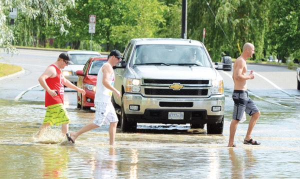
That wet weather peaked on Wednesday when a late-afternoon deluge opened up over the south end of the city and flooded basements, garages and yards in the area of Wilson Street near Green Avenue.
Len Robson, the city’s public works manager, said crews and equipment were dispatched to help pump out water from in and around 10 homes.
“There was a massive amount of rainfall that came down in a short duration,” he said.
“The storm sewers take all they can take, then the rest of it starts building up on the road surfaces until it spills into the low points.”
Environment Canada recorded eight millimetres of rain at the airport Wednesday, although the flooded area appeared to receive much more.
Such brief, problematic downpours happen every year, “but not to that intensity. That was just about one of the worst I’ve seen here,” Robson said.
“In that case (Wednesday), we kind of had to wait until the storm sewers got rid of the water before we could even pump the yards out, because there was nowhere for it to go. There was just so much water that came so quickly.”
By this time next week, however, people might be wishing for a little rain.
Environment Canada is expecting the temperature to hit 30 C on Saturday, then climb from there to a high of 35 C by Tuesday, just 1.7 C off the record for that date set in 1942.
“There are some potential flies in the ointment, like high-level cloud and the fact the ground has been cool and wet for a little while, that might mute it for a little bit,” Lundquist said.
“But certainly when I see that type of ridge building on the computer models, I expect that this type of year we’ll see record-breaking temperatures.”
The hot spell is expected to last for up to two weeks. Lundquist said a three-month projection shows “a slightly higher chance” that the summer will be hotter than average, although the coming spell by itself could make that prediction come true.
He’s less certain about whether the Okanagan broke any rainfall marks in June. With just a few days left in the month, the totals are a little below where they were in 2012, “and we had record-breaking amounts last year,” Lundquist said.
The meteorologist organized the conference call to help media warn the public to be prepared for the impending hot stretch and offer tips on how to stay safe in severe weather.
Lundquist implored people to ensure they stay hydrated, resist the urge to leave pets in vehicles even for a few moments, and check in on elderly people.
He said the public should also be aware of the threats posed by heat, wind, rain and lighting, and be ready to seek cover quickly: “When thunder roars, go indoors.”