The evacuation order placed on 27 properties and homes in the upper Fairview Road area has been rescinded.
The Regional District of Okanagan-Similkameen stated that residents can now go back to their homes and access their properties, however the properties remain under evacuation alert.
The number of properties or homes under evacuation alert due to the Testalinden Creek wildfire has been reduced from 285 to 180 homes.
The RDOS stated in a release that the reduction of the evacuation alert is due to the fire moving north away from homes in the rural areas west of Osoyoos.
All homes and properties within the existing evacuation alert area north of Testalinden Creek and west of Oliver are still under an evacuation alert.
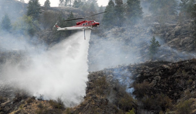
Despite rainfall, the Testalinden Creek wildfire grew to over 4,000 hectares Saturday.
According to the BC Wildfire Service, Testalinden, burning approximately seven kilometres south of Oliver, is now estimated at 4295 hectares and is considered 60 per cent contained.
Due to movement of the Testalinden Creek fire northwards, the Regional District Okanagan Similkameen expanded the existing evacuation alert on Aug. 28, and later expanded the evacuation order to include recreational areas as well as properties in the Fairview Road area.
An evacuation order remains in effect for 27 properties or homes along Fairview Road, Old Golf Course Road and Willowbrook Roads, as well as recreation sites at Burnell (Sawmill), Ripley and Madden Lakes. An additional 258 properties or homes in the Oliver and Osoyoos areas remain on evacuation alert.
Read more:
The Regional District is asking that people stay away from all Crown Land areas south of Orofino Creek Road in the Burnell (Sawmill) Lake, Ripley Lake and Madden Lake areas.
The north flank of the fire received approximately three millimetres of rain on Aug. 29, which will help efforts to some extent on the fire but forecast winds quickly dried out areas that received precipitation.
Read more:
Winds continue to increase activity on the fire creating smoke with open flame which is visible from Oliver and along Highway 97, as combustible material burns on the slopes around Testalinden, Hester and Reed Creeks.
The BC Wildfire Service has 190 firefighters deployed fighting the blaze, including nine helicopters and 21 pieces of heavy equipment.
Useful links:
- EmergencyInfoBC Online source for emergency alerts about natural disasters and provider of public education and preparedness information.
- DriveBC Road conditions and closures
- BC Air Quality The Air Quality Health Index is a health protection tool that is designed to help you make decisions to protect your health by limiting short-term exposure to air pollution and adjusting your activity levels during increased levels of air pollution.
- Interior Health During a forest fire, be aware of health risks associated with exposure to smoke, food safety in power outages, and water quality.